| Wind Watch is a registered educational charity, founded in 2005. |
BP releases map of wind project sites
Translate: FROM English | TO English
Translate: FROM English | TO English
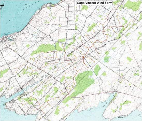
BP Alternative Energy today released an image of proposed sites for wind turbines and power lines for the Cape Vincent Wind Project; however, the public may get a better view early next week when BP plans to post the image on its Web site, BP project manager James H. Madden said.
While the map is preliminary, he said, it represents a large move forward in the project process.
The proposed turbines, overlayed on a U.S. Geological Survey map with outdated road names, were spread around the town along red power lines. Their locations were bounded on the southeast by the Lyme town line, on the northwest by wetlands, and elsewhere by a proximity to Lake Ontario and other waterways.
Madden said the company plans to use an updated map as soon as possible.
31 July 2008
This article is the work of the source indicated. Any opinions expressed in it are not necessarily those of National Wind Watch.
The copyright of this article resides with the author or publisher indicated. As part of its noncommercial educational effort to present the environmental, social, scientific, and economic issues of large-scale wind power development to a global audience seeking such information, National Wind Watch endeavors to observe “fair use” as provided for in section 107 of U.S. Copyright Law and similar “fair dealing” provisions of the copyright laws of other nations. Send requests to excerpt, general inquiries, and comments via e-mail.
| Wind Watch relies entirely on User Funding |
 (via Paypal) |
 (via Stripe) |
Share:


